Kod: 05255245
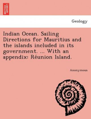
Indian Ocean. Sailing Directions for Mauritius and the islands included in its government. ... With an appendix
Autor Anonymous
bTitle:/b Indian Ocean. Sailing Directions for Mauritius and the islands included in its government. ... With an appendix: Reżunion Island.br/br/bPublisher:/b British Library, Historical Print Editionsbr/br/The British Library is ... więcej
- Język:
 Angielski
 - Oprawa: Miękka
- Liczba stron: 104
Wydawca: British Library, Historical Print Editions, 2011
- Więcej informacji o książce

Zobacz książki o podobnej tematyce
-

Is Jesus the Only Savior?
20.73 € -19 % -

Ashes and the Star-Cursed King
25.11 € -19 % -

All This Twisted Glory (This Woven Kingdom)
10.67 € -18 % -

PEERLESS WUSHUANG
19.21 € -25 % -

Ashes and the Star-Cursed King
17.79 € -10 % -

Multivariable and Vector Calculus: An Introduction
71.27 € -21 % -

Frankincense Essential Oil: Everything You Need To Know About The Essential Oil Fit For Kings
11.07 € -2 % -

Art Oracles
17.28 € -5 % -

VECTOR CALCULUS
490.63 € -

Scottish Life and Society Volume 6
66.90 € -4 % -

Polish School of Philosophy of Medicine
187.81 € -

Mineral and Thermal Groundwater Resources
122.12 € -

Medical Tourism
173.77 € -

Sara
12.80 € -16 % -

Performing Black Masculinity
169.10 € -

Transforming NATO
152.62 € -

Bible Readings for Caregivers
12.19 € -

Community Nutrition: Applying Epidemiology To Contemporary Practice
155.78 € -

Therapeutic Targets of the TNF Superfamily
187.81 € -

L'enfant
22.56 € -10 % -

The Sleeping Beauty, 1 Audio-CD
24.90 €
Bon podarunkowy: Radość gwarantowana
- Podaruj bon o dowolnej wartości, a my się zajmiemy resztą.
- Bon podarunkowy dotyczy całej naszej oferty.
- Możesz wydrukować elektroniczny bon z e-maila a następnie przekazać go obdarowanemu.
- Ważność bonu wynosi 12 miesięcy od daty wystawienia.
Więcej informacji o Indian Ocean. Sailing Directions for Mauritius and the islands included in its government. ... With an appendix
Za ten zakup dostaniesz 51 punkty
 Opis
Opis
bTitle:/b Indian Ocean. Sailing Directions for Mauritius and the islands included in its government. ... With an appendix: Reżunion Island.br/br/bPublisher:/b British Library, Historical Print Editionsbr/br/The British Library is the national library of the United Kingdom. It is one of the world's largest research libraries holding over 150 million items in all known languages and formats: books, journals, newspapers, sound recordings, patents, maps, stamps, prints and much more. Its collections include around 14 million books, along with substantial additional collections of manuscripts and historical items dating back as far as 300 BC.br/br/The GEOLOGY collection includes books from the British Library digitised by Microsoft. The works in this collection contain a number of maps, charts, and tables from the 16th to the 19th centuries documenting geological features of the natural world. Also contained are textbooks and early scientific studies that catalogue and chronicle the human stance toward water and land use. Readers will further enjoy early historical maps of rivers and shorelines demonstrating the artistry of journeymen, cartographers, and illustrators. br/br/++++br/The below data was compiled from various identification fields in the bibliographic record of this title. This data is provided as an additional tool in helping to insure edition identification:br/++++br/br/b
 Szczegóły książki
Kategoria Książki po angielsku Earth sciences, geography, environment, planning Earth sciences
20.53 €
- Pełny tytuł: Indian Ocean. Sailing Directions for Mauritius and the islands included in its government. ... With an appendix
- Podtytuł: Réunion Island.
- Autor: Anonymous
- Język:
 Angielski
 - Oprawa: Miękka
- Liczba stron: 104
- EAN: 9781241732929
- ISBN: 1241732922
- ID: 05255245
- Wydawca: British Library, Historical Print Editions
- Waga: 200 g
- Wymiary: 246 × 189 × 6 mm
- Data wydania: 22. June 2011
Ulubione w innej kategorii
-

Nature of Nature
21.75 € -25 % -

Earth System History
99.64 € -

Geotechnical Instrumentation and Applications
100.46 € -5 % -

Cold breath of sleeping volcanoes
25.11 € -19 % -

Introduction to Paleobiology and the Fossil Record , 2nd Edition
75.95 € -

Science of the Earth
35.48 € -5 % -

Information
17.18 € -23 % -

Cowen's History of Life 6e
75.04 € -7 % -

Earth System Science: A Very Short Introduction
9.34 € -28 % -

Mesoscale Meteorology in Midlatitudes
101.27 € -6 % -

Nature Illuminated
17.89 € -1 % -

Ecology and Management of Forest Soils 5e
136.25 € -

Earth History and Palaeogeography
96.08 € -2 % -

Quaternary Dating Methods
108.08 € -

Terraforming Mars
262.65 € -

Geochemistry, Second Edition
121.91 € -

Fundamental Planetary Science
79.41 € -

Computational Fairy Tales
13.01 € -2 % -

ISE Physical Geology
78.80 € -5 % -

Geoscience for Petroleum Engineers
113.07 € -

Bohdalec
58.46 € -

New Trends in Earth-Science Outreach and Engagement
122.12 € -

Hunterian Lectures in Comparative Anatomy, May & June 1837 (Cloth)
112.15 € -

Quaternary Dating Methods
107.47 € -

TOGAF Version 9
131.68 € -

Climatic Change at High Elevation Sites
187.81 € -

Mineralogy of Quartz and Silica Minerals
63.44 € -13 % -

Sailing Directory for the Baltic, Comprising a General Description of the Bays, Harbours, Islands, Included Between the Sound and the Gulf of Finland.
20.53 € -

Mutual Evolution of Earth and Humanity
57.55 € -18 % -

Language of the Earth 2e
53.38 € -

Python Recipes for Earth Sciences
90.70 € -

Art of Business Process Modeling
11.07 € -1 % -

Geological and Mud Logging in Drilling Control
61.92 € -

Introduction to Applied and Environmental Geophysics 2e
105.95 € -
![Crystallography for Beginners. with an Appendix on the Use of the Blowpipe and the Determination of Common Minerals, Etc. [With 3 Tables of Diagrams.] Crystallography for Beginners. with an Appendix on the Use of the Blowpipe and the Determination of Common Minerals, Etc. [With 3 Tables of Diagrams.]](https://media.libris.to/jacket/07986811t.jpg)
Crystallography for Beginners. with an Appendix on the Use of the Blowpipe and the Determination of Common Minerals, Etc. [With 3 Tables of Diagrams.]
20.12 € -19 % -

Micrometeorology
122.12 € -

Handbook of Archaeological Sciences
176.21 € -

Earth Science, Global Edition
119.57 € -

Geology and Mineralogy of Gemstones
132.18 € -

In Six Days
14.73 € -19 % -

Red Sea
130.66 € -4 % -

Blue Planet - An Introduction to Earth System Science 3e
222.89 € -

Crystallography
111.13 € -

Viticulture and Winemaking under Climate Change
63.44 € -13 % -

Principles of Engineering Management
242.52 € -

Exploring Venus as a Terrestrial Planet
105.03 € -

Geology of Clays
61.92 € -

Introduction to the Theory of Climate
122.12 € -

Synthetic Aperture Radar (SAR) Techniques and Applications
70.76 € -12 %
Osobní odběr Bratislava a 2642 dalších
Copyright ©2008-24 najlacnejsie-knihy.sk Wszelkie prawa zastrzeżonePrywatnieCookies


 Vrácení do měsíce
 Zdarma od 49.99 €
 02/210 210 99 (8-15.30h)