
Kód: 01658477
Inland Water Altimetry
Autor Jérôme Benveniste, Stefano Vignudelli, Andrey G. Kostianoy
This book will bring an integrated view of the state-of-the art in the matter to the water scientists eager to add Radar Altimetry to their toolkit. It describes experience in application of satellite altimetry to the different in ... celý popis
- Jazyk:
 Angličtina
 - Väzba: Pevná
- Počet strán: 500
Nakladateľ: Springer-Verlag Berlin and Heidelberg GmbH & Co. KG, 2023
- Viac informácií o knihe

Mohlo by sa vám tiež páčiť
-

Czerny - 40 Daily Exercises, Op. 337: Schirmer Library of Classics Volume 149 Piano Technique
11.26 € -2 % -

Jane of Lantern Hill
9 € -23 % -

Routledge Library Editions: Communication Studies
1775.18 € -

One Piece: Ace's Story, Vol. 1
9 € -23 % -

The Bach Cello Suites
15.66 € -18 % -

Collided Special Edition
21.29 € -

Elden Ring: The Road to the Erdtree
13.82 € -4 %
Darujte túto knihu ešte dnes
- Objednajte knihu a vyberte Zaslať ako darček.
- Obratom obdržíte darovací poukaz na knihu, ktorý môžete ihneď odovzdať obdarovanému.
- Knihu zašleme na adresu obdarovaného, o nič sa nestaráte.
Informovať o naskladnení knihy
Zadajte do formulára e-mailovú adresu a akonáhle knihu naskladníme, zašleme vám o tom správu. Postrážime všetko za vás.
Viac informácií o knihe Inland Water Altimetry
Nákupom získate 479 bodov
 Anotácia knihy
This book will bring an integrated view of the state-of-the art in the matter to the water scientists eager to add Radar Altimetry to their toolkit. It describes experience in application of satellite altimetry to the different inland seas, lakes and rivers in the World. It presents the principal problems related to the altimetry derived products in inland seas, lakes and rivers and ways of their improvement. This publication is based on numerous satellite and observational data collected and analyzed by the authors of the various chapters in the framework of a set of international projects, performed in Europe, Russia, USA, and China. The book will contribute both to the ongoing International Altimeter Service effort and to the building of a sustained Continental Water observing system in the perspective of GMES and GEOSS initiatives, supplied with satellite data from the series of Sentinel-3 satellites, the Jason series and further on the revolutionary SWOT Satellite Mission. This book is aimed at specialists concerned with research in the various fields of satellite altimetry and remote sensing of Continental Waters. The book will also be interesting for lecturers, students and post-graduate students. Pratical applications stemming from the book content will be supported by, and can be advertised through, the ESA-CNES Basic Radar Altimetry Toolbox and its Radar Altimetry Tutorial ( )
 Parametre knihy
Zaradenie knihy Books in English Earth sciences, geography, environment, planning Earth sciences Hydrology & the hydrosphere
193.89 €
- Celý názov: Inland Water Altimetry
- Autor: Jérôme Benveniste, Stefano Vignudelli, Andrey G. Kostianoy
- Jazyk:
 Angličtina
 - Väzba: Pevná
- Počet strán: 500
- EAN: 9783642226786
- ISBN: 3642226787
- ID: 01658477
- Nakladateľ: Springer-Verlag Berlin and Heidelberg GmbH & Co. KG
- Rozmery: 235 × 155 mm
- Dátum vydania: 11. June 2023
Obľúbené z iného súdka
-

Caddo
34.61 € -

Introducing Oceanography
20.07 € -

Oceanology
47.21 € -7 % -

Oceans of Kansas, Second Edition
41.37 € -19 % -

Ocean Animals Sticker Activity Book
6.24 € -30 % -

Hydrological Drought
222.06 € -

Lakes: A Very Short Introduction
11.67 € -19 % -

Our Changing Planet
61.45 € -15 % -

Under the Sea-Wind
15.35 € -16 % -

Rainfall-Runoff Modelling - The Primer 2e
112.46 € -

Attacking Ocean
24.88 € -13 % -

Oceans: A Very Short Introduction
11.67 € -19 % -

World Is Blue
14.84 € -15 % -

Middle Sea
17.71 € -15 % -

Water Wizard
28.47 € -23 % -

Groundwater Hydrology
107.33 € -

Log from the Sea of Cortez
18.73 € -23 % -

Industrial Wastewater Treatment
214.68 € -

Oceans
32.25 € -

Alien Ocean
44.44 € -
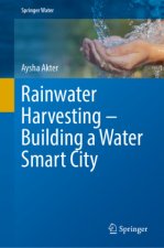
Rainwater Harvesting-Building a Water Smart City
202.18 € -

Ocean Worlds
14.43 € -23 % -

Essentials of Oceanography
123.72 € -

Atlantic
16.58 € -23 % -
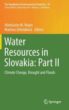
Water Resources in Slovakia: Part II
377.34 € -

Atchafalaya River Basin
40.14 € -

Principles of Snow Hydrology
72.41 € -

Water
22.01 € -6 % -

Applied Hydrogeology
100.37 € -

Advanced Dam Engineering for Design, Construction, and Rehabilitation
277.26 € -

Fluvial Processes in Geomorphology: Seco
36.45 € -13 % -

Gravel-Bed Rivers - Processes and Disasters
260.98 € -

Geology for Geotechnical Engineers
59.30 € -

Water Treatment for Purification from Cyanobacteria and Cyanotoxins
208.02 € -

Tracers in Hydrology
130.07 € -

Tsunamis
11.36 € -13 % -

Mapping the Deep
26.72 € -
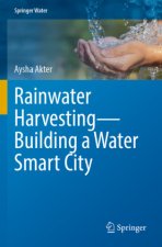
Rainwater Harvesting-Building a Water Smart City
174.94 € -

Ocean Surface Waves: Their Physics And Prediction (2nd Edition)
113.69 € -

Introduction to Physical Oceanography
152.20 € -

Sea is Not Made of Water
19.14 € -15 % -

Rivers: A Very Short Introduction
13.82 € -4 % -

Book of Tides
30.92 € -13 % -

Offshore Structures
127.10 € -

Sea Ice Biota
287.20 € -

Design of Hydraulic Gates
387.89 € -

Descriptive Physical Oceanography
107.85 € -

Manual of Offshore Surveying for Geoscientists and Engineers
214.68 € -

Advanced Treatment Technologies for Fluoride Removal in Water
202.18 €
Collection points Bratislava a 2642 dalších
Copyright ©2008-24 najlacnejsie-knihy.sk All rights reservedPrivacyCookies


 15549 collection points
 Delivery 2.99 €
 02/210 210 99 (8-15.30h)