
Code: 04520540
A History of the County of Somerset
by R. W. Dunning
Andersfield, Cannington, and North Pether-ton hundreds together occupy the Lower Par-rett valley stretching from the Quantock ridge in the west to King's Sedgemoor in the east, and from the Bristol Channel in the north to the rive ... more
- Language:
 English
 - Binding: Hardback
- Number of pages: 418
Publisher: Oxford University Press, 1992
- More about this

102.83 €
RRP: 102.85 €
You save 0.03 €

In stock at our supplier
Shipping in 14 - 18 days
You might also like
-

Hotel Oneira
16.28 € -13 % -

To Bless the Space Between Us
38.09 € -

Ecological Implications of Contemporary Agriculture
104.77 € -

Handloader's Manual - A Treatise on Modern Cartridge Components and Their Assembly by the Individual Shooter Into Accurate Ammunition to Best Suit His
53.25 € -

Every Bitter Thing
20.17 € -

Biblical Women-Submissive?
28.06 € -4 % -

Haderer Jahrbuch Nr. 9
15.35 € -9 %
Give this book as a present today
- Order book and choose Gift Order.
- We will send you book gift voucher at once. You can give it out to anyone.
- Book will be send to donee, nothing more to care about.
More about A History of the County of Somerset
You get 254 loyalty points
 Book synopsis
Andersfield, Cannington, and North Pether-ton hundreds together occupy the Lower Par-rett valley stretching from the Quantock ridge in the west to King's Sedgemoor in the east, and from the Bristol Channel in the north to the river Tone in the south. By the late 11th century the settlement pattern was dense, especially between the Quantocks and the Par-rett, an area crossed by the Saxon 'herpath' in the north and including the 10th-century strongholds of Athelney and Lyng in the south and the Domesday royal manors of Can-nington, North Petherton, and Creech St. Michael. The origin of the medieval royal park at North Petherton can be traced to a pre--Conquest royal forest on the Quantocks, and North Petherton was an extensive minster parish. Bridgwater, a chartered borough from 1200, is the only significant town. By the later Middle Ages its port served central, south, and west Somerset, and until the 19th century heavy goods continued to be transported along the Parrett, the Tone, and the Bridgwater and Taunton canal into Dorset and Devon. The pattern of settlement is varied, with a few nucleated villages, roadside villages, and many dispersed hamlets. Interlocking parish boundaries indicate complex economic units and late parochial formation. Arable farming predominated until the 16th century, partly in open arable fields. In the 17th century there was an emphasis on stock rearing and an increase in dairying and orchards, large-ly the result of improved drainage. Cheese was an important product of the area in the 18th century, and in the 19th baskets from locally grown willow. Woollen cloth production con-tinued into the 17th century. From the late 17th century the alluvial clays of the Parrett valley provided material for the bricks and tiles for which Bridgwater became well known in the 19th century. Substantial estates whose houses wholly or partially survive include Fairfield, Gothelney, Gurney Street, West Bower, and Sydenham. Halswell House was from the later 17th century the grandest mansion in the area, and Enmore Castle was built in the later 18th century.
 Book details
Book category Knihy po anglicky Humanities History Regional & national history
102.83 €
- Full title: A History of the County of Somerset
- Subtitle: Volume VI: Andersfield, Cannington, and North Petherton Hundreds (Bridgwater and Neighbouring Parishes)
- Author: R. W. Dunning
- Language:
 English
 - Binding: Hardback
- Number of pages: 418
- EAN: 9780197227800
- ID: 04520540
- Publisher: Oxford University Press
- Weight: 1918 g
- Dimensions: 305 × 208 × 44 mm
- Date of publishing: 01. January 1992
Trending among others
-

Hundred Years' War on Palestine
12.08 € -24 % -

Ten Myths About Israel
12.59 € -16 % -

Strange Death of Europe
16.58 € -23 % -

Rise And Fall Of The Third Reich
22.01 € -23 % -

Citizens
22.01 € -23 % -

Last Voyage of the Lusitania
20.68 € -

Voynich Manuscript
41.27 € -

Moshe Dayan
27.34 € -9 % -
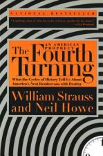
The Fourth Turning
20.68 € -1 % -

General's Son
20.27 € -4 % -

Reverence for Wood
9.21 € -19 % -

Yitzhak Rabin
16.58 € -10 % -

Hell's Cartel
21.19 € -13 % -

Interpreting Our Heritage
30.31 € -

Paradise Lost
12.79 € -24 % -

Games without Rules
19.25 € -6 % -

Voices of the Foreign Legion
17.40 € -5 % -

American Nations
16.69 € -14 % -
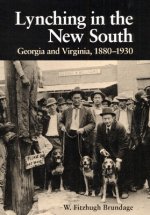
Lynching in the New South
34.30 € -

City of Fortune
14.43 € -23 % -
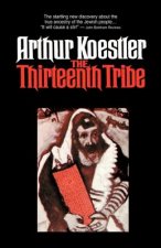
Thirteenth Tribe
16.89 € -
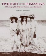
Twilight of the Romanovs
38.20 € -23 % -

Habsburg Monarchy 1809-1918
16.58 € -23 % -

Ethnic Cleansing of Palestine
14.43 € -23 % -

Decline and Fall of the Roman Empire
5.93 € -21 % -

Palestine
20.27 € -21 % -

The Secret Diaries Of Miss Anne Lister: Vol. 1
13.61 € -14 % -

Giza Power Plant
16.07 € -16 % -

The Balkans, 1804-2012
22.01 € -23 % -
Age Of Revolution
16.58 € -23 % -
Millennium
13.20 € -22 % -
Alexiad
17.81 € -20 % -

Heraclius, Emperor of Byzantium
33.38 € -18 % -

1948
33.48 € -

Annals of Imperial Rome
14.43 € -23 % -

Strike and Hold
30 € -3 % -

Diana: Her True Story - In Her Own Words
11.05 € -23 % -

How to be a Victorian
14.43 € -23 % -

The Oxford History of Ancient Egypt
15.46 € -23 % -

Londoners
11.26 € -25 % -

History of Japan
16.48 € -18 % -

Illustrated Encyclopedia of Uniforms of the American War of Independence
22.01 € -23 % -

Olympic, Titanic, Britannic
30.31 € -15 % -

Medieval Monsters
11.15 € -23 % -
Secret History
12.28 € -23 % -

The Thirteenth Tribe
12.69 € -

Footnotes in Gaza
27.34 € -13 % -

Biggest Prison on Earth
14.43 € -23 % -

Great Gatsby (Wisehouse Classics Edition)
16.17 € -37 %
Osobný odber Bratislava a 2642 dalších
Copyright ©2008-24 najlacnejsie-knihy.sk Všetky práva vyhradenéSúkromieCookies


 21 miliónov titulov
 Vrátenie do mesiaca
 02/210 210 99 (8-15.30h)