Code: 53375048
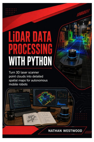
LiDAR Data Processing with Python
by Nathan Westwood
Turn raw 3D laser scans into clean, useful maps that autonomous mobile robots can understand.A LiDAR sensor can capture thousands or millions of distance measurements, but a cloud of points is not automatically a robot-ready map. ... more


- Language:
 English
 - Binding: Paperback
- Number of pages: 188
Publisher: Independently published, 2026
- More about this

18.19 €
RRP: 20.20 €
You save 2.01 €

You might also like
-

Berserk Deluxe Volume 1
37.71 € -21 % -

Moonwalk
14.05 € -

Murdoku
13.54 € -27 % -

Threshing Day (Wing and Claw Collection)
17.79 € -29 % -

The Score
12.33 € -20 % -

Berserk Deluxe Volume 2
35.28 € -32 % -

Dancing The Dream
24.66 € -30 % -

Threshing Day (Limited Deluxe Edition)
18.80 € -30 % -

White Nights
4.54 € -14 % -

Berserk Deluxe Volume 3
55.30 € -

The Mistake
11.32 € -16 % -

Kid's Box New Generation Level 2 Activity Book with Digital Pack British English
10.91 € -8 % -

The Deal
12.33 € -9 % -

Murdoku Volume 2: Back in Time
13.74 € -29 % -

The Odyssey
15.97 € -25 % -

Jujutsu Kaisen, Vol. 30
9.70 € -25 % -

Onyx Storm (Deluxe Limited Edition) (The Empyrean, 3)
24.06 € -25 % -

Jujutsu Kaisen, Vol. 26
9.90 € -20 % -

Kid's Box New Generation Level 2 Pupil's Book with eBook British English
17.89 € -7 % -

Witch Hat Atelier: Grimoire Edition 2
35.28 € -29 % -

Lord of Mysteries, Vol. 1: The Clown, Part I
15.36 € -22 %
Give this book as a present today
- Order book and choose Gift Order.
- We will send you book gift voucher at once. You can give it out to anyone.
- Book will be send to donee, nothing more to care about.
Availability alert
Enter your e-mail address and once book will be available,
we will send you a message. It's that simple.
More about LiDAR Data Processing with Python
You get 44 loyalty points
 Book synopsis
Turn raw 3D laser scans into clean, useful maps that autonomous mobile robots can understand.
A LiDAR sensor can capture thousands or millions of distance measurements, but a cloud of points is not automatically a robot-ready map. Raw scans must be inspected, cleaned, transformed, aligned, segmented, and converted into spatial information that navigation software can use.
LiDAR Data Processing with Python teaches that complete workflow step by step. Using Python, NumPy, Open3D, laspy, SciPy, Matplotlib, scikit-learn, optional PDAL tools, and ROS 2 concepts, you will learn how to turn point clouds into practical occupancy, elevation, and traversability maps for autonomous mobile robots.
This beginner-friendly guide will help you:
- Understand how LiDAR sensors measure distance and produce point clouds
- Work with X, Y, and Z coordinates, intensity, returns, timestamps, classifications, and colour attributes
- Prepare a clean Python workspace for point-cloud processing
- Load, inspect, and convert PCD, PLY, LAS, LAZ, XYZ, CSV, and NumPy point-cloud files
- Read large LiDAR files safely without exhausting memory
- Visualise point clouds from multiple viewpoints using Open3D and Matplotlib
- Remove invalid coordinates, distant points, robot-body points, noise, and outliers
- Use voxel, uniform, random, statistical, radius, and intensity-based filtering methods
- Work with coordinate frames, translation, rotation, transformation matrices, and sensor-to-robot conversions
- Detect ground surfaces, slopes, ramps, and height above ground
- Segment floors, walls, ceilings, pallets, boxes, and other objects
- Group points with DBSCAN and measure objects with bounding boxes
- Align and combine multiple scans using registration and ICP concepts
- Create two-dimensional occupancy grid maps for robot navigation
- Build elevation and traversability maps that identify slopes, rough ground, curbs, steps, and unsafe terrain
- Process recorded and live robot LiDAR data safely
- Connect processed clouds and maps to ROS 2 navigation workflows
- Improve performance with chunking, tiling, reusable functions, configurable pipelines, and batch jobs
- Build a complete robot-ready mapping pipeline as the final project
The book builds one practical workflow rather than disconnected demonstrations. You will begin by inspecting individual point-cloud files, then progress through cleaning, transformation, ground detection, segmentation, registration, occupancy mapping, elevation mapping, traversability analysis, ROS 2 publishing, and complete pipeline organisation.
No LiDAR sensor is required to begin. Sample files support the core exercises, while live-data and robot-navigation sections can be explored later with suitable hardware and ROS 2 software.
The focus is practical robot mapping. You will learn why coordinate frames, units, thresholds, timestamps, map resolution, obstacle expansion, and validation matter before a robot is allowed to trust the resulting map.
Build cleaner point-cloud workflows, create better spatial maps, and prepare LiDAR data for safer autonomous mobile robot navigation.Book details
18.19 €
- Full title: LiDAR Data Processing with Python
- Subtitle: Turn 3D Laser Scanner Point Clouds into Detailed Spatial Maps for Autonomous Mobile Robots
- Author: Nathan Westwood
- Language: English
- Binding: Paperback
- Number of pages: 188
- EAN: 9798189694639
- ID: 53375048
- Publisher: Independently published
- Weight: 236 g
- Dimensions: 229 × 152 × 12 mm
- Date of publishing: 29. July 2026
Osobný odber Bratislava a 13163 dalších
Copyright ©2008-26 najlacnejsie-knihy.sk Všetky práva vyhradenéSúkromieCookies

 24 miliónov titulov
 Vrátenie do mesiaca
 02/210 210 99 (8-15.30h)