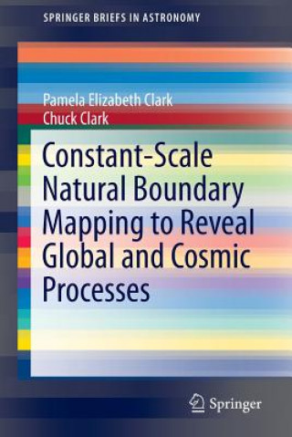
Kód: 01428905
Constant Scale Natural Boundary Mapping in the Solar System and Beyond
Autor Pamela Elizabeth Clark, Chuck Clark
Whereas conventional maps can be expressed as outward-expanding formulae with well-defined central features and relatively poorly defined edges, Constant Scale Natural Boundary (CSNB) maps have well-defined boundaries that result ... celý popis
- Jazyk:
 Angličtina
 - Väzba: Brožovaná
- Počet strán: 114
Nakladateľ: Springer, Berlin, 2013
- Viac informácií o knihe

69.78 €

Skladom u dodávateľa v malom množstve
Odosielame za 12 - 15 dní
Potrebujete viac kusov?Ak máte záujem o viac kusov, preverte, prosím, najprv dostupnosť titulu na našej zákazníckej podpore.
Pridať medzi želanie
Mohlo by sa vám tiež páčiť
-

Discovering Mathematics
14.41 € -

Le Corbusier's Pavilion for Zurich: Model and Prototype of an Ideal Exhibition Space
30.55 € -13 % -

Vault
10.98 € -23 % -

Seat on the Aisle, Please!
37.11 € -

Inside Relational Databases with Examples in Access
43.66 € -

Kámen a flétna a to ještě není všechno II.
10.78 € -6 % -

Úvahy o české politické krizi
3.72 € -5 %
Darčekový poukaz: Radosť zaručená
- Darujte poukaz v ľubovoľnej hodnote, a my sa postaráme o zvyšok.
- Poukaz sa vzťahuje na všetky produkty v našej ponuke.
- Elektronický poukaz si vytlačíte z e-mailu a môžete ho ihneď darovať.
- Platnosť poukazu je 12 mesiacov od dátumu vystavenia.
Viac informácií o knihe Constant Scale Natural Boundary Mapping in the Solar System and Beyond
Nákupom získate 175 bodov
 Anotácia knihy
Whereas conventional maps can be expressed as outward-expanding formulae with well-defined central features and relatively poorly defined edges, Constant Scale Natural Boundary (CSNB) maps have well-defined boundaries that result from natural processes and thus allow spatial and dynamic relationships to be observed in a new way useful to understanding these processes. CSNB mapping presents a new approach to visualization that produces maps markedly different from those produced by conventional cartographic methods. §In this approach, any body can be represented by a 3D coordinate system. For a regular body, with its surface relatively smooth on the scale of its size, locations of features can be represented by definite geographic grid (latitude and longitude) and elevation, or deviation from the triaxial ellipsoid defined surface. A continuous surface on this body can be segmented, its distinctive regional terranes enclosed, and their inter-relationships defined, by using selected morphologically identifiable relief features (e.g., continental divides, plate boundaries, river or current systems). In this way, regions of distinction on a large, essentially spherical body can be mapped as two-dimensional facets with their boundaries representing regional to global-scale asymmetries (e.g., continental crust, continental and oceanic crust on the Earth, farside original thicker crust and nearside thinner impact punctuated crust on the Moon). In an analogous manner, an irregular object such as an asteroid, with a surface that is rough on the scale of its size, would be logically segmented along edges of its impact-generated faces. §Bounded faces are imagined with hinges at occasional points along boundaries, resulting in a foldable shape model. Thus, bounded faces grow organically out of the most compelling natural features. Obvious boundaries control the map s extremities, and peripheral regions are not dismembered or grossly distorted as in conventional map projections. 2D maps and 3D models grow out of an object s most obvious face or terrane edges, instead of arbitrarily by imposing a regular grid system or using regularly shaped facets to represent an irregular surface.
 Parametre knihy
Zaradenie knihy Knihy po anglicky Earth sciences, geography, environment, planning Geography Geographical information systems (GIS) & remote sensing
69.78 €
- Celý názov: Constant Scale Natural Boundary Mapping in the Solar System and Beyond
- Podnázov: A New Paradigm for Providing Insights into Physical Processes
- Autor: Pamela Elizabeth Clark, Chuck Clark
- Jazyk:
 Angličtina
 - Väzba: Brožovaná
- Počet strán: 114
- EAN: 9781461477617
- ISBN: 1461477611
- ID: 01428905
- Nakladateľ: Springer, Berlin
- Hmotnosť: 250 g
- Rozmery: 235 × 155 × 6 mm
- Dátum vydania: 28. September 2013
Obľúbené z iného súdka
-
Designing Better Maps
62.22 € -13 % -

Cartography.
65.95 € -5 % -

Mastering Geospatial Analysis with Python
63.73 € -

Semiology of Graphics
142.80 € -

Geographic Information Science and Systems 4e
221.67 € -5 % -
GIS for Science
53.14 € -
Geocaching
20.16 € -

Introduction to Geographical Information Systems, An
79.57 € -

Connections and Content
56.67 € -
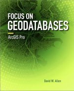
Focus on Geodatabases in ArcGIS Pro
71.80 € -
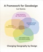
Framework for Geodesign
95.20 € -
Esri Guide to GIS Analysis, Volume 3
54.15 € -

Springer Handbook of Geographic Information
439.73 € -

Reconstruction and Analysis of 3D Scenes
211.99 € -
Geoinformatics
37.81 € -

Mastering ArcGIS Server Development with JavaScript
56.97 € -

LiDAR Remote Sensing and Applications
133.22 € -

GIS For Dummies
39.32 € -
ArcGIS Book
24.90 € -
Python For ArcGIS
149.86 € -

Spring Boot Messaging
57.38 € -
GNSS - Global Navigation Satellite Systems
221.98 € -

GIS in Land and Property Management
275.13 € -
Spatial Statistics and Geostatistics
86.22 € -

Programming GPS and OpenStreetMap Applications with Java
92.07 € -
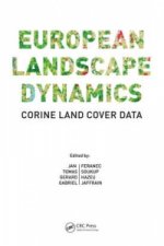
European Landscape Dynamics
267.46 € -

Introduction to GIS Programming and Fundamentals with Python and ArcGIS (R)
148.55 € -
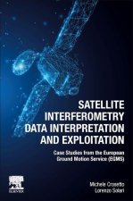
Satellite Interferometry Data Interpretation and Exploitation
191.82 € -
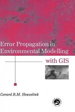
Error Propagation in Environmental Modelling with GIS
160.86 € -

QGIS Python Programming Cookbook -
63.63 € -

Learning ArcGIS Pro
63.63 € -

GPS For Dummies 2e
27.73 € -

Mastering QGIS -
70.49 € -
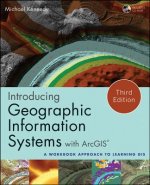
Introducing Geographic Information Systems with ArcGIS - A Workbook Approach to Learning GIS, Third Edition
136.05 € -
Integration of GIS and Remote Sensing
280.47 € -

Energy of Nations
54.25 € -
Physical Principles of Remote Sensing
201.70 € -

New Developments and Environmental Applications of Drones
223.69 € -

Mapping with ArcGIS Pro
56.97 € -

GIS and Spatial Analysis for the Social Sciences
127.17 € -

Satellite Altimetry Over Oceans and Land Surfaces
275.13 € -

Learning QGIS 2.0
32.06 € -
ArcGIS Pro and ArcGIS Online Applications in Water and Environmental Sciences
90.06 € -
Open Source GIS
211.39 € -

Recent Advances in Remote Sensing for Crop Growth Monitoring
106.25 € -
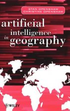
Artificial Intelligence in Geography
373.16 € -
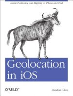
Geolocation in iOS
25.20 € -
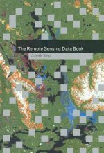
Remote Sensing Data Book
144.11 € -
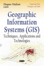
Geographic Information Systems (GIS)
349.86 € -12 %
Osobný odber Bratislava a 2642 dalších
Copyright ©2008-24 najlacnejsie-knihy.sk Všetky práva vyhradenéSúkromieCookies


 21 miliónov titulov
 Vrátenie do mesiaca
 02/210 210 99 (8-15.30h)