Kód: 16050662
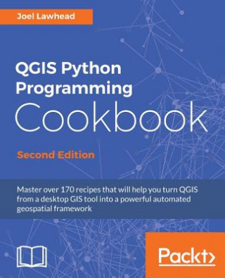
QGIS Python Programming Cookbook -
Autor Joel Lawhead
Master over 170 recipes that will help you turn QGIS from a desktop GIS tool into a powerful automated geospatial frameworkKey Features:Delve into the undocumented features of the QGIS APIGet a set of user-friendly recipes that ca ... celý popis


- Jazyk:
 Angličtina
- Väzba: Brožovaná
- Počet strán: 464
Nakladateľ: Packt Publishing Limited, 2017
- Viac informácií o knihe

54.66 €
Bežne: 55.74 €
Ušetríte 1.08 €

Skladom u dodávateľa
Odosielame za 9 - 13 dní
Mohlo by sa vám tiež páčiť
-

Berserk Deluxe Volume 4
47.22 € -11 % -

Goodnight Punpun, Vol. 7
13.56 € -21 % -

Mushoku Tensei: Jobless Reincarnation (Light Novel) Vol. 3
11.85 € -29 % -

Harry Potter and the Order of the Phoenix
10.04 € -29 % -

HR Giger
29.74 € -

Owning Your Own Shadow
14.56 € -24 % -

Philip K. Dick
29.13 € -25 % -

The Mathematical Principles of Natural Philosophy: Philosophiae Naturalis Principia Mathematica
16.07 € -6 % -

Cuzco 1536-37
16.97 € -24 % -

Call Me By Your Name
10.14 € -17 % -

Death Note, Vol. 4
16.57 € -

Banana Fish, Vol. 4
9.84 € -23 % -

Kantha: Sustainable Textiles and Mindful Making
20.69 € -25 % -

CCNA 200-301 Official Cert Guide, Volume 1
39.68 € -25 % -

Digital Empires
25.11 € -12 % -

Short Stories in French
11.14 € -28 % -

Character Design Quarterly 18
12.25 € -25 % -

The Werewolf in Lore and Legend
15.06 € -25 % -

Keystone Approach
28.83 € -2 % -

American Gods
14.36 € -29 % -

The Raven Scholar
16.87 € -15 % -

To Kill a Kingdom
11.55 € -25 % -

Second Book of Modern Lace Knitting
11.55 € -25 % -

Birds of Borneo
36.17 € -25 % -

First Templar Nation
14.06 € -30 % -

Art of Philosophy
15.06 € -25 % -

Art and Making of Alien: Covenant
31.95 € -20 % -

Amenti Oracle Feather Heart Deck and Guide Book
24.71 € -20 % -

Botanical Art with Scientific Illustration
26.92 € -9 % -

The Strangest Secret
9.44 € -25 % -

K9 Personal Protection
29.33 € -25 % -

English & Albanian Grammar: Gramatika Shqip & Anglisht
14.36 € -7 % -

How to be filled with the Holy Spirit
3.81 € -25 % -

No Second Chance
11.75 € -25 % -

Veterinary Nursing of Exotic Pets and Wildlife 3rd Edition
77.57 € -4 % -

My Best Pop-up Construction Site Book
11.55 € -25 % -

British Civilization
50.94 € -11 % -

Peppa Pig: George's New Dinosaur
7.13 € -29 % -

The Tucci Cookbook
29.13 € -25 % -

Artisan Guest Book/Classic Black
13.25 € -27 % -

Python Scripting for ArcGIS Pro
100.99 € -

Wagamama Cookbook
21.09 € -25 % -

Bird Pellets
45.21 € -

New York, New York, Vol. 2
22.70 € -15 % -

Under Rose-Tainted Skies
7.93 € -26 % -

Python for Geospatial Data Analysis
57.27 € -25 % -

The Metabolic Miracle
14.06 € -30 % -

French Picture Dictionary Coloring Book
10.14 € -24 % -

Revolution at the Gates
31.85 € -17 % -

Sd.Kfz.7 Mittlerer Zugkraftwagen 8t
22.70 € -9 % -

Temple of Love
20.19 € -20 % -

Mastering Geospatial Analysis with Python
54.66 € -1 % -

Parsifal
15.87 € -25 % -

Market Justice
129.83 € -

Pyqgis Programmer's Guide
59.28 € -

BABOK V3 Revision Guide
18.68 € -7 % -

Discover QGIS 3.x
70.23 € -2 % -

Discover Qgis
2.50 € -76 % -

QGIS Python Programming Cookbook
54.66 € -1 % -

LiDAR Remote Sensing and Applications
138.17 € -

Ukrainian Children's Book: The Wonderful Wizard Of Oz
7.43 € -6 % -

Gay Man's Guide to Life
24.21 € -25 % -

A Love Supreme. Live in Seattle
40.69 € -15 % -

Manifest Your Year: 12-Month Perpetual Planner
13.96 € -26 % -

Mob Daughter
16.47 € -25 % -

Grab the Helm
22.71 € -9 % -

Chinese Communist Party as Organizational Emperor
79.48 € -

Molecular Physics and Elements of Quantum Chemistry
100.08 € -9 % -

Shape of Future Technology
51.34 € -7 % -

Evidence-based Practice in Nursing
70.03 € -10 % -

Single Breath
11.75 € -25 % -

Manuscript Culture in Renaissance Italy
54.56 € -

WORLD ALMANAC 2024 WORD SEARCH
8.63 € -25 % -

[ Two YEHs ] Coloring & Activity Book - Animal 2: English - Chinese
7.83 € -6 % -

Swing Shift: Book 2
14.56 € -6 % -

Grade 9-1 GCSE Design & Technology AQA Revision Guide
10.14 € -10 % -

The Lord's Maddening Miss
6.72 € -24 %
Darujte túto knihu ešte dnes
- Objednajte knihu a vyberte Zaslať ako darček.
- Obratom obdržíte darovací poukaz na knihu, ktorý môžete ihneď odovzdať obdarovanému.
- Knihu zašleme na adresu obdarovaného, o nič sa nestaráte.
Viac informácií o knihe QGIS Python Programming Cookbook -
Nákupom získate 133 bodov
 Anotácia knihy

Master over 170 recipes that will help you turn QGIS from a desktop GIS tool into a powerful automated geospatial frameworkKey Features:
- Delve into the undocumented features of the QGIS API
- Get a set of user-friendly recipes that can automate entire geospatial workflows by connecting Python GIS building blocks into comprehensive processes
- This book has a complete code upgrade to QGIS 2.18 and 30 new, valuable recipes
Book Description:
QGIS is a desktop geographic information system that facilitates data viewing, editing, and analysis. Paired with the most efficient scripting language-Python, we can write effective scripts that extend the core functionality of QGIS.Based on version QGIS 2.18, this book will teach you how to write Python code that works with spatial data to automate geoprocessing tasks in QGIS. It will cover topics such as querying and editing vector data and using raster data. You will also learn to create, edit, and optimize a vector layer for faster queries, reproject a vector layer, reduce the number of vertices in a vector layer without losing critical data, and convert a raster to a vector. Following this, you will work through recipes that will help you compose static maps, create heavily customized maps, and add specialized labels and annotations. As well as this, we'll also share a few tips and tricks based on different aspects of QGIS.
What you will learn:
- Use Python and QGIS to produce captivating GIS visualizations and build complex map layouts
- Find out how to effectively use the poorly-documented and undocumented features of the QGIS Python API
- Automate entire geospatial workflows by connecting Python GIS building blocks into comprehensive processes
- Create, import, and edit geospatial data on disk or in-memory
- Change QGIS settings programmatically to control default behavior
- Automatically generate PDF map books
- Build dynamic forms for field input
Who this book is for:
This book is for geospatial analysts who want to learn more about automating everyday GIS tasks as well as programmers responsible for building GIS applications. The short, reusable recipes make concepts easy to understand and combine so you can build larger applications that are easy to maintain.
Parametre knihy
Zaradenie knihy Knihy po anglicky Earth sciences, geography, environment, planning Geography Geographical information systems (GIS) & remote sensing
54.66 €
- Celý názov: QGIS Python Programming Cookbook -
- Autor: Joel Lawhead
- Jazyk: Angličtina
- Väzba: Brožovaná
- Počet strán: 464
- EAN: 9781787124837
- ISBN: 1787124835
- ID: 16050662
- Nakladateľ: Packt Publishing Limited
- Hmotnosť: 892 g
- Rozmery: 192 × 234 × 32 mm
- Dátum vydania: 14. March 2017
Obľúbené z iného súdka
-

Cartography.
67.22 € -12 % -

Geocaching
15.06 € -25 % -

Principles of GNSS, Inertial, and Multisensor Integrated Navigation Systems, Second Edition
142.19 € -10 % -

Mastering QGIS -
58.68 € -4 % -

ArcGIS Pro and ArcGIS Online Applications in Water and Environmental Sciences
80.38 € -14 % -

Semiology of Graphics
83.70 € -12 % -
GIS for Science
50.44 € -
Geographic Information Science and Systems 4e
220.97 € -10 % -
Esri Guide to GIS Analysis, Volume 3
57.37 € -

Learning ArcGIS Pro
54.66 € -1 % -

Introduction to Geographical Information Systems, An
77.87 € -14 % -

Geoinformatics
19.69 € -14 % -

Spring Boot Messaging
45.21 € -9 % -

Framework for Geodesign
91.84 € -

Mastering ArcGIS Server Development with JavaScript
48.23 € -1 % -
Spatial Simulation - Exploring Pattern and Process
63.80 € -10 % -
Focus on Geodatabases in ArcGIS Pro
121.49 € -

Springer Handbook of Geographic Information
356.04 € -

Reconstruction and Analysis of 3D Scenes
173.74 € -7 % -

Programming GPS and OpenStreetMap Applications with Java
94.65 € -
GNSS - Global Navigation Satellite Systems
184.09 € -

ArcGIS Book
22.90 € -10 % -

Manual of Geospatial Science and Technology
401.16 € -
Remote Sensing and Geospatial Technologies for Coastal Ecosystem Assessment and Management
204.39 € -7 % -

GIS for Surface Water
74.86 € -

Harnessing Earth Observation for Coastal Engineering
176.25 € -
Google Earth Engine and Artificial Intelligence for Earth Observation
170.02 € -

Agent-Based Modelling and Geographical Information Systems
41.29 € -10 % -
Remote Sensing Data Book
89.23 € -
Sustainable Development and Geospatial Technology
224.79 € -7 % -

Advances in Remote Sensing for Forest Fire Management
169.02 € -10 % -

Photogrammetry and Remote Sensing
118.87 € -10 % -
Roles of Remote Sensing in Nature Conservation
163.49 € -7 % -

Towards AI Large Model: Remote Sensing Image Intelligent Interpretation and Application
173.74 € -7 % -

Understanding Different Geographies
102.29 € -7 % -
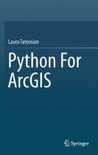
Python For ArcGIS
120.08 € -9 % -
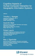
Cognitive Aspects of Human-Computer Interaction for Geographic Information Systems
204.39 € -7 % -

Remote Sensing, Big Data, and GeoAI
151.13 € -9 % -

Advanced Applications in Remote Sensing of Agricultural Crops and Natural Vegetation
238.46 € -

GIS And Generalisation
193.94 € -
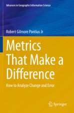
Metrics That Make a Difference
132.94 € -7 % -

Innovations in 3D Geo Information Systems
204.39 € -7 % -

Earth Observation of Global Changes (EOGC)
102.29 € -7 % -

Geospatial Technologies in Environmental Management
153.34 € -7 % -

Mapping with ArcGIS Pro
48.23 € -1 % -
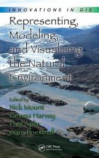
Representing, Modeling, and Visualizing the Natural Environment
208.61 € -

Urban Air Pollution Monitoring by Ground-Based Stations and Satellite Data
122.69 € -7 % -

Intelligent Systems for Crisis Management
102.29 € -7 % -

Application of Antibody Probes to Study Populations of Specific Bacteria in Aerobic and Anaerobic Bioprocesses
53.95 €
Osobný odber Bratislava a 13652 dalších
Copyright ©2008-26 najlacnejsie-knihy.sk Všetky práva vyhradenéSúkromieCookies

 25 miliónov titulov
 Vrátenie do mesiaca
 02/210 210 99 (8-15.30h)
