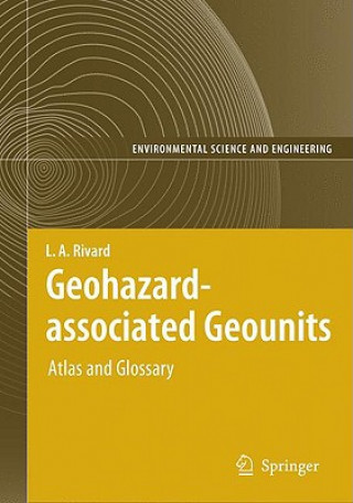
Kód: 01558700
Geohazard-associated Geounits
Autor L. A. Rivard, Q. H. J. Gwyn
Globally there has been a marked increase in both the frequency and cost of natural disasters occurring due to geological, hydrological and meteorological causes. According to the United States National Academy of Sciences losses ... celý popis
- Jazyk:
 Angličtina
 - Väzba: Pevná
- Počet strán: 1056
Nakladateľ: Springer-Verlag Berlin and Heidelberg GmbH & Co. KG, 2004
- Viac informácií o knihe

Mohlo by sa vám tiež páčiť
-

Why Startups Fail
29.83 € -4 % -

Quantum Mechanics
151.86 € -

My Blue Piano
15.63 € -3 % -

Buying Beauty
102.50 € -

Oxford Playscripts: Homer's Odyssey
21.04 € -

Stormwater Management for Smart Growth
214.20 € -

Encyclopedia of Clinical Neuropsychology
1353.64 €
Darčekový poukaz: Radosť zaručená
- Darujte poukaz v ľubovoľnej hodnote, a my sa postaráme o zvyšok.
- Poukaz sa vzťahuje na všetky produkty v našej ponuke.
- Elektronický poukaz si vytlačíte z e-mailu a môžete ho ihneď darovať.
- Platnosť poukazu je 12 mesiacov od dátumu vystavenia.
Viac informácií o knihe Geohazard-associated Geounits
Nákupom získate 1198 bodov
 Anotácia knihy
Globally there has been a marked increase in both the frequency and cost of natural disasters occurring due to geological, hydrological and meteorological causes. According to the United States National Academy of Sciences losses caused by natural disasters have quadrupled in the last twenty years. This book, conceived as a technical manual deals with various aspects of geohazards - using photogeology and remote sensing. It is unique in that the succinct text supports the illustrations, and is aimed at geoscience professionals and university students, devised as a quick-reference standardized presentation of 177 globally occurring photo-geomorphological units and an equal number of variants derived from a comprehensive image-resolvable and ordered genetic classification of geounits. The selected geounits are uniquely classed and identified as either agents of, or susceptible to, one or more of the 14 general types of geohazards. The data set of each geounit systematically integrates characterizing graphics, ground- and air- perspective photos to introduce interpreted aerospace mono/stereoscopic photos and images demonstrating their detectability and mappability.
 Parametre knihy
Zaradenie knihy Knihy po anglicky Earth sciences, geography, environment, planning Geography Geographical information systems (GIS) & remote sensing
483.71 €
- Celý názov: Geohazard-associated Geounits
- Podnázov: Atlas and Glossary
- Autor: L. A. Rivard, Q. H. J. Gwyn
- Jazyk:
 Angličtina
 - Väzba: Pevná
- Počet strán: 1056
- EAN: 9783540202967
- ISBN: 354020296X
- ID: 01558700
- Nakladateľ: Springer-Verlag Berlin and Heidelberg GmbH & Co. KG
- Hmotnosť: 2673 g
- Rozmery: 260 × 193 × 48 mm
- Dátum vydania: 01. March 2004
Obľúbené z iného súdka
-

Designing Better Maps
70 € -4 % -

Cartography.
65.91 € -6 % -

Mastering Geospatial Analysis with Python
65.91 € -

Semiology of Graphics
144.71 € -

Geographic Information Science and Systems 4e
224.83 € -4 % -
GIS for Science
52.83 € -

Geocaching
20.43 € -3 % -

Introduction to Geographical Information Systems, An
79.60 € -

Connections and Content
54.46 € -
Focus on Geodatabases in ArcGIS Pro
80.93 € -

Framework for Geodesign
104.24 € -
Esri Guide to GIS Analysis, Volume 3
61.21 € -

Springer Handbook of Geographic Information
445.59 € -

Reconstruction and Analysis of 3D Scenes
205.82 € -

Geoinformatics
39.13 € -

Mastering ArcGIS Server Development with JavaScript
58.96 € -

LiDAR Remote Sensing and Applications
135 € -

GIS For Dummies
40.05 € -

ArcGIS Book
32.49 € -
Python For ArcGIS
151.86 € -

Spring Boot Messaging
58.14 € -
GNSS - Global Navigation Satellite Systems
251.71 € -

GIS in Land and Property Management
331.43 € -

Spatial Statistics and Geostatistics
89.42 € -

Programming GPS and OpenStreetMap Applications with Java
93.30 € -
European Landscape Dynamics
271.03 € -
Satellite Interferometry Data Interpretation and Exploitation
194.38 € -

Introduction to GIS Programming and Fundamentals with Python and ArcGIS (R)
154.01 € -
Error Propagation in Environmental Modelling with GIS
166.68 € -

QGIS Python Programming Cookbook -
65.91 € -

Learning ArcGIS Pro
65.91 € -

GPS For Dummies 2e
26.97 € -4 % -

Mastering QGIS -
72.96 € -

Introducing Geographic Information Systems with ArcGIS - A Workbook Approach to Learning GIS, Third Edition
137.86 € -

Integration of GIS and Remote Sensing
290.34 € -

Energy of Nations
56.30 € -
Physical Principles of Remote Sensing
219.82 € -

New Developments and Environmental Applications of Drones
226.67 € -

GIS and Spatial Analysis for the Social Sciences
128.87 € -

Mapping with ArcGIS Pro
58.96 € -

Satellite Altimetry Over Oceans and Land Surfaces
306.08 € -

Learning QGIS 2.0
33.21 € -
Open Source GIS
214.20 € -

ArcGIS Pro and ArcGIS Online Applications in Water and Environmental Sciences
91.26 € -
Geographic Information Systems (GIS)
354.53 € -12 % -
Geographical Information Science
108.73 € -

Spatial Conservation Prioritization
246.60 € -

Digital Terrain Modelling
214.20 € -
Thermal Infrared Remote Sensing
225.45 €
Osobný odber Bratislava a 2642 dalších
Copyright ©2008-24 najlacnejsie-knihy.sk Všetky práva vyhradenéSúkromieCookies


 21 miliónov titulov
 Vrátenie do mesiaca
 02/210 210 99 (8-15.30h)