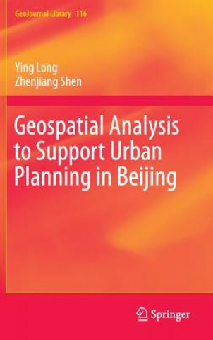
Kód: 09285146
Geospatial Analysis to Support Urban Planning in Beijing
Autor Zhenjiang Shen, Ying Long
This book describes a comprehensive framework of novel simulation approaches, conventional urban models and related data mining techniques that helps develop planning support systems in Beijing as well as other mega-metropolitan a ... celý popis
- Jazyk:
 Angličtina
 - Väzba: Pevná
- Počet strán: 272
Nakladateľ: Springer International Publishing AG, 2015
- Viac informácií o knihe

70.80 €

Skladom u dodávateľa v malom množstve
Odosielame za 12 - 17 dní
Potrebujete viac kusov?Ak máte záujem o viac kusov, preverte, prosím, najprv dostupnosť titulu na našej zákazníckej podpore.
Pridať medzi želanie
Mohlo by sa vám tiež páčiť
-

Home Chic
27.92 € -

Welshman Remembers
24.24 € -

Through His Blood
24.04 € -

Works of the REV. John Witherspoon, D.D., L.L.D., Late President of the College at Princeton, New-Jersey
49.62 € -

I Got Life
37.03 € -

LEGO (R) Minifigure A Visual History New Edition: With exclusive LEGO spaceman minifigure!
30.28 € -19 % -

Check iT - Einzelhandelskaufleute Prüfungsvorbereitung, kurz und knapp
16.16 €
Darčekový poukaz: Radosť zaručená
- Darujte poukaz v ľubovoľnej hodnote, a my sa postaráme o zvyšok.
- Poukaz sa vzťahuje na všetky produkty v našej ponuke.
- Elektronický poukaz si vytlačíte z e-mailu a môžete ho ihneď darovať.
- Platnosť poukazu je 12 mesiacov od dátumu vystavenia.
Viac informácií o knihe Geospatial Analysis to Support Urban Planning in Beijing
Nákupom získate 175 bodov
 Anotácia knihy
This book describes a comprehensive framework of novel simulation approaches, conventional urban models and related data mining techniques that helps develop planning support systems in Beijing as well as other mega-metropolitan areas. It investigates the relationships between human behaviors and spatial patterns in order to simulate activities in an urban space, visualize planning alternatives, and support decision making. The book first explains urban space using geometric patterns, such as points, networks, and polygons, that help identify patterns of household and individual human behavior. Next, it details how novel simulation methodologies, such as cellular automaton and multi-agent systems, and conventional urban modeling, such as spatial interaction models, can be used to identify an optimal or a simulated solution for a better urban form. The book develops a comprehensive land use and transportation integrated model used to explore the spatial patterns of mutual interaction between human mobility and urban space. This model can help forecast the distribution of different types of households, rent prices and land prices, as well as the distribution of routes and traffic volume based on an appraisal of labor demand and supply. This book shows how geospatial analysis can be a useful tool for planners and decision makers to assist in ascertaining patterns of activities and support urban planning. Offering both novel and conventional approaches to urban modeling, it will appeal to researchers, students, and policy makers looking for the optimal way to plan the development of a mega-metropolitan area.
 Parametre knihy
Zaradenie knihy Knihy po anglicky Earth sciences, geography, environment, planning Regional & area planning
70.80 €
- Celý názov: Geospatial Analysis to Support Urban Planning in Beijing
- Autor: Zhenjiang Shen, Ying Long
- Jazyk:
 Angličtina
 - Väzba: Pevná
- Počet strán: 272
- EAN: 9783319193410
- ISBN: 3319193414
- ID: 09285146
- Nakladateľ: Springer International Publishing AG
- Hmotnosť: 5738 g
- Rozmery: 235 × 155 × 242 mm
- Dátum vydania: 23. September 2015
Obľúbené z iného súdka
-

Game Audio Tutorial
73.66 € -
Cnc Programming
24.04 € -

Spatial Planning Systems and Practices in Europe
81.75 € -

GIS for Planning and the Built Environment
253.96 € -

Software Testing
18.41 € -
Regional Economic Development
139.46 € -

Disney Stories
70.80 € -

Beginning JSP, JSF and Tomcat Web Development
39.38 € -4 % -

Network Society
109.68 € -

Oracle High-performance SQL Tuning
74.69 € -4 % -

City of Change and Challenge
51.66 € -
Urban Resilience for Risk and Adaptation Governance
218.15 € -

Radical Solutions to the Housing Supply Crisis
23.93 € -

3D Graphics for Game Programming
139.87 € -

The Application of Economic Techniques in Environmental Impact Assessment
214.46 € -

Spatial Planning Systems and Practices in Europe
279.13 € -

From Farm to Firm
42.97 € -

Nature-Based Solutions to Climate Change Adaptation in Urban Areas
60.05 € -

Urban and Regional Planning in Canada
77.96 € -

Best Development Practices
91.88 € -

Crossing Borders
281.08 € -

DESIGNING Australia's Cities
281.08 € -

Development and the Law
179.57 € -

Environmental Valuation
81.75 € -

From the Forest to the Sea - Public Lands Management and Marine Spatial Planning
217.64 € -

Industrial Property Markets in Western Europe
333.26 € -

Making European Space
46.14 € -

Mexican National Cinema
217.64 € -

Planning the Good Community
118.58 € -

Rise of the English Regions?
69.06 € -

Auckland Unplugged
67.63 € -

Credit to the Community
255.70 € -

Himachal Pradesh Development Report
66.40 € -

TVA and the Tellico Dam
44.40 € -

Urban Economics and Land Use in America: The Transformation of Cities in the Twentieth Century
71.52 € -

Vulnerable Cities:
170.16 € -

Scotland: the Challenge of Devolution
51.66 € -

Bioregional Planning and Design: Volume I
226.95 € -
Geoecology of Landscape Dynamics
121.55 € -

New Way of Living
58.21 € -

Land Use Changes in the Czech Republic 1845-2010
145.70 € -

Innovations in Design
35.60 € -2 % -

Strategy of Chinese Rural-Urban Coordinated Development to 2020 Part 2
31.30 € -60 % -

Narratives of Neglect
74.07 € -

In Motion
51.15 € -

Regulation through Revelation
59.03 € -

Unemployment and Social Exclusion
46.14 € -

New Labour and Planning
192.26 € -

Planning and Decentralization
271.36 €
Osobný odber Bratislava a 2642 dalších
Copyright ©2008-24 najlacnejsie-knihy.sk Všetky práva vyhradenéSúkromieCookies


 21 miliónov titulov
 Vrátenie do mesiaca
 02/210 210 99 (8-15.30h)