
Kód: 04952038
GPS Satellite Surveying
Autor Alfred Leick, Lev Rapoport, Dmitry Tatarnikov
Employ the latest satellite positioning tech with this extensive guide"GPS Satellite Surveying" is the classic text on the subject, providing the most comprehensive coverage of global navigation satellite systems applications for ... celý popis
- Jazyk:
 Angličtina
 - Väzba: Pevná
- Počet strán: 840
Nakladateľ: John Wiley & Sons Inc, 2015
- Viac informácií o knihe

212.14 €

Skladom u dodávateľa v malom množstve
Odosielame za 10 - 14 dní
Potrebujete viac kusov?Ak máte záujem o viac kusov, preverte, prosím, najprv dostupnosť titulu na našej zákazníckej podpore.
Pridať medzi želanie
Mohlo by sa vám tiež páčiť
-

Mapping Past Landscapes in the Lower Lea Valley
30.53 € -

Satellites
174.93 € -

Understanding the Navstar
137.81 € -
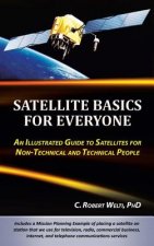
Satellite Basics for Everyone
24.76 € -4 % -

Guide to Japanese Role-Playing Games
51.56 € -

Navstar Global Positioning System
137.81 € -

Managing Tourism and Hospitality Services
240.86 € -

Full Swing
17.89 € -1 % -

Introduction To Semiconductor Device Modelling
70.57 € -

Joan Jonas
30.22 € -

Desert Peoples: Archaeological Perspectives
59.45 € -

Children's Use of Board Games in Psychotherapy
138.52 € -

Colonial Angels
35.68 € -

Bond
40.64 € -

Stop Me If You've Heard This
12.23 € -

Georgic Revolution
79.87 € -

Grand Challenges in Environmental Sciences
66.73 € -

Kant and Idealism
100.70 € -

Just Elections
42.46 € -

Scottish Heinemann Maths 3: Activity Book Easy Order Pack
172.20 € -

Following Atticus
12.12 € -23 %
Darčekový poukaz: Radosť zaručená
- Darujte poukaz v ľubovoľnej hodnote, a my sa postaráme o zvyšok.
- Poukaz sa vzťahuje na všetky produkty v našej ponuke.
- Elektronický poukaz si vytlačíte z e-mailu a môžete ho ihneď darovať.
- Platnosť poukazu je 12 mesiacov od dátumu vystavenia.
Viac informácií o knihe GPS Satellite Surveying
Nákupom získate 531 bodov
 Anotácia knihy
Employ the latest satellite positioning tech with this extensive guide"GPS Satellite Surveying" is the classic text on the subject, providing the most comprehensive coverage of global navigation satellite systems applications for surveying. Fully updated and expanded to reflect the field's latest developments, this new edition contains new information on GNSS antennas, Precise Point Positioning, Real-time Relative Positioning, Lattice Reduction, and much more. New contributors offer additional insight that greatly expands the book's reach, providing readers with complete, in-depth coverage of geodetic surveying using satellite technologies. The newest, most cutting-edge tools, technologies, and applications are explored in-depth to help readers stay up to date on best practices and preferred methods, giving them the understanding they need to consistently produce more reliable measurement.Global navigation satellite systems have an array of uses in military, civilian, and commercial applications. In surveying, GNSS receivers are used to position survey markers, buildings, and road construction as accurately as possible with less room for human error. "GPS Satellite Surveying" provides complete guidance toward the practical aspects of the field, helping readers to: Get up to speed on the latest GPS/GNSS developmentsUnderstand how satellite technology is applied to surveyingExamine in-depth information on adjustments and geodesyLearn the fundamentals of positioning, lattice adjustment, antennas, and moreThe surveying field has seen quite an evolution of technology in the decade since the last edition's publication. This new edition covers it all, bringing the reader deep inside the latest tools and techniques being used on the job. Surveyors, engineers, geologists, and anyone looking to employ satellite positioning will find "GPS Satellite Surveying" to be of significant assistance.
 Parametre knihy
Zaradenie knihy Knihy po anglicky Earth sciences, geography, environment, planning Geography Geographical information systems (GIS) & remote sensing
212.14 €
- Celý názov: GPS Satellite Surveying
- Autor: Alfred Leick, Lev Rapoport, Dmitry Tatarnikov
- Jazyk:
 Angličtina
 - Väzba: Pevná
- Počet strán: 840
- EAN: 9781118675571
- ISBN: 1118675576
- ID: 04952038
- Nakladateľ: John Wiley & Sons Inc
- Hmotnosť: 1258 g
- Rozmery: 243 × 164 × 52 mm
- Dátum vydania: 07. April 2015
Obľúbené z iného súdka
-

Designing Better Maps
68.75 € -9 % -

Cartography.
66.83 € -9 % -

Mastering Geospatial Analysis with Python
65.21 € -

Semiology of Graphics
143.17 € -

Geographic Information Science and Systems 4e
222.45 € -4 % -
GIS for Science
52.27 € -

Geocaching
20.21 € -3 % -

Introduction to Geographical Information Systems, An
79.57 € -

Connections and Content
53.89 € -

Focus on Geodatabases in ArcGIS Pro
69.16 € -5 % -

Framework for Geodesign
106.37 € -
Esri Guide to GIS Analysis, Volume 3
60.56 € -

Springer Handbook of Geographic Information
440.87 € -

Reconstruction and Analysis of 3D Scenes
203.64 € -

Geoinformatics
38.72 € -

Mastering ArcGIS Server Development with JavaScript
58.34 € -

LiDAR Remote Sensing and Applications
133.57 € -

GIS For Dummies
39.63 € -

ArcGIS Book
28.10 € -

Python For ArcGIS
150.25 € -

Spring Boot Messaging
57.53 € -

GIS in Land and Property Management
327.92 € -

Spatial Statistics and Geostatistics
88.47 € -

Programming GPS and OpenStreetMap Applications with Java
92.31 € -

European Landscape Dynamics
268.16 € -

Satellite Interferometry Data Interpretation and Exploitation
192.32 € -

Introduction to GIS Programming and Fundamentals with Python and ArcGIS (R)
152.38 € -

Error Propagation in Environmental Modelling with GIS
164.91 € -

QGIS Python Programming Cookbook -
65.21 € -

Learning ArcGIS Pro
65.21 € -

GPS For Dummies 2e
26.69 € -4 % -

Introducing Geographic Information Systems with ArcGIS - A Workbook Approach to Learning GIS, Third Edition
136.40 € -

Mastering QGIS -
72.19 € -

Integration of GIS and Remote Sensing
287.27 € -

Energy of Nations
55.71 € -

Physical Principles of Remote Sensing
217.50 € -

New Developments and Environmental Applications of Drones
224.27 € -

GIS and Spatial Analysis for the Social Sciences
127.50 € -

Satellite Altimetry Over Oceans and Land Surfaces
290.40 € -

Mapping with ArcGIS Pro
58.34 € -

Learning QGIS 2.0
32.85 € -

Open Source GIS
211.93 € -

ArcGIS Pro and ArcGIS Online Applications in Water and Environmental Sciences
90.29 € -

Geographic Information Systems (GIS)
350.77 € -12 % -
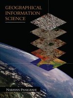
Geographical Information Science
107.58 € -

Spatial Conservation Prioritization
243.99 € -

Digital Terrain Modelling
211.93 € -

Thermal Infrared Remote Sensing
223.06 € -

Conceptual Modeling for Traditional and Spatio-Temporal Applications
137.81 €
Osobný odber Bratislava a 2642 dalších
Copyright ©2008-24 najlacnejsie-knihy.sk Všetky práva vyhradenéSúkromieCookies


 21 miliónov titulov
 Vrátenie do mesiaca
 02/210 210 99 (8-15.30h)