Kód: 10000661
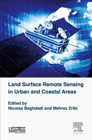
Land Surface Remote Sensing in Urban and Coastal Areas
Autor Nicolas Baghdadi, Mehrez Zribi
In the last ten years, spacial observation of the Earth, and particularly of continental surfaces, have expanded considerably with the launch of increasing numbers of satellites covering various applications (hydrology, biosphere, ... celý popis
- Jazyk:
 Angličtina
 - Väzba: Pevná
- Počet strán: 392
Nakladateľ: ISTE Press Ltd - Elsevier Inc, 2016
- Viac informácií o knihe

Mohlo by sa vám tiež páčiť
-

Reign of Antichrist
22.42 € -

Claiming His Desire
13.72 € -4 % -

Bentley's Miscellany, Volume 38
53.15 €
Darujte túto knihu ešte dnes
- Objednajte knihu a vyberte Zaslať ako darček.
- Obratom obdržíte darovací poukaz na knihu, ktorý môžete ihneď odovzdať obdarovanému.
- Knihu zašleme na adresu obdarovaného, o nič sa nestaráte.
Viac informácií o knihe Land Surface Remote Sensing in Urban and Coastal Areas
Nákupom získate 512 bodov
 Anotácia knihy
In the last ten years, spacial observation of the Earth, and particularly of continental surfaces, have expanded considerably with the launch of increasing numbers of satellites covering various applications (hydrology, biosphere, flow of surface, snow, ice, landslide, floods). This has paved the way for an explosion in the use of teledection data.  This book brings essential coverage of the space techniques of observation on continental surfaces. The authors explore major applications and provide a detailed chapter for the physical principles, physics of measurement and data processing for each technique, bringing you up-to-date descriptions of techniques used by leading scientists in the field of remote sensing and Earth observation. This volume highlights many urban applications with a chapter on the use of remote sensing in urban planning. The authors analyze urban scenes with a mobile mapping vehicle and object recognition. The following chapter discusses the use of remote sensing in urban and suburban areas in the territorial decision process. A second part of this book begins with a chapter on the use of remote sensing for color application of water. The second chapter discusses the physical parameters achievable lidar in coastal and inland waters with particularly bathymetry and altimetry as well as the characterization of the water column properties. The last chapter deals in particular with the color of the water. The third chapter concerns the coastal applications with the use of increasingly frequent lidar technique for the study of coastal dynamics in particular with the identification of the coastline and the estimation of sediment budgets. The third part consists of two chapters analyze the dynamics of mangroves, one of the most fragile forests on earth. Clear and concise descriptions of modern methodsExplores the most current remote sensing techniques with physical aspects of the measurement (theory) and their applicationsPhysical principles, measurement and data processing chapters are provided for each technique described
 Parametre knihy
Zaradenie knihy Knihy po anglicky Earth sciences, geography, environment, planning Earth sciences Geology & the lithosphere
207.41 €
- Celý názov: Land Surface Remote Sensing in Urban and Coastal Areas
- Autor: Nicolas Baghdadi, Mehrez Zribi
- Jazyk:
 Angličtina
 - Väzba: Pevná
- Počet strán: 392
- EAN: 9781785481604
- ISBN: 1785481606
- ID: 10000661
- Nakladateľ: ISTE Press Ltd - Elsevier Inc
- Hmotnosť: 752 g
- Rozmery: 161 × 237 × 26 mm
- Dátum vydania: 05. September 2016
Obľúbené z iného súdka
-

Soil Science Simplified 6e
117.07 € -

Geology For Dummies
20.99 € -20 % -

Past Time: Geology in European and American Art
45.37 € -2 % -

White River Badlands
44.24 € -4 % -

Paleoclimate
45.98 € -

Lost World of Fossil Lake
48.13 € -4 % -

Pleistocene Boundary and the Beginning of the Quaternary
101.80 € -

Nature and Properties of Soils, The, Global Edition
95.66 € -

S & S Guide to Rocks and Minerals
24.88 € -6 % -

Mycorrhizal Planet
33.38 € -18 % -

H2O
12.28 € -23 % -

Story of Earth
19.04 € -2 % -

Structural Geology
64.62 € -

Sea without Fish
39.73 € -22 % -

Geological Field Techniques
82.34 € -

Environmental Chemistry
158.45 € -

Annals of the Former World
24.47 € -19 % -
Radon: A Tracer for Geological, Geophysical and Geochemical Studies
314.75 € -

The Geology of Kuwait
48.23 € -

Reading the Rocks
16.17 € -21 % -

Stable Isotope Geochemistry
114.61 € -

Anthropocene: A Very Short Introduction
9.11 € -24 % -

Ice Age
83.16 € -

Brief History of Geology
44.44 € -

Rocks: A Very Short Introduction
11.67 € -19 % -

Glaciation: A Very Short Introduction
10.13 € -22 % -

Geology: A Very Short Introduction
11.67 € -19 % -

Mineral Resources, Economics and the Environment
78.86 € -

Making of Europe
82.65 € -

Timefulness
40.96 € -10 % -

Global Geomorphology
87.87 € -

Historical Geology
87.16 € -17 % -

Principles of Geology, Volume 1
32.46 € -31 % -

Igneous and Metamorphic Petrology 2e
152.71 € -

Plate Tectonics: A Very Short Introduction
11.67 € -19 % -

Landscapes and Geomorphology: A Very Short Introduction
11.67 € -19 % -

Ore Deposit Geology
85.11 € -

Soil and Environmental Chemistry
132.02 € -

Tectonic Geomorphology 2e
125.87 € -

Fossils: A Very Short Introduction
11.67 € -19 % -

Earth on Show
65.65 € -

Last Giant of Beringia
29.39 € -

Quaternary Paleoenvironments - Submerged Landscapes of the European Continental Shelf.
141.14 € -

Earth: An Introduction to Physical Geology, Global Edition
88.18 € -

Pleistocene
277.26 € -

Silicate Glasses and Melts
303.38 € -

Worlds Before Adam
112.97 € -

Principles of Geology, Volume 2
78.65 € -

Principles of Geology, Volume 3
78.65 €
Osobný odber Bratislava a 2642 dalších
Copyright ©2008-24 najlacnejsie-knihy.sk Všetky práva vyhradenéSúkromieCookies


 21 miliónov titulov
 Vrátenie do mesiaca
 02/210 210 99 (8-15.30h)