
Kód: 04579571
Landsat and Beyond
Autor Committee on Implementation of a Sustained Land Imaging Program, Space Studies Board, Division on Engineering and Physical Sciences, National Research
In 1972 NASA launched the Earth Resources Technology Satellite (ETRS), now known as Landsat 1, and on February 11, 2013 launched Landsat 8. Currently the United States has collected 40 continuous years of satellite records of land ... celý popis
- Jazyk:
 Angličtina
 - Väzba: Brožovaná
- Počet strán: 76
Nakladateľ: National Academies Press, 2014
- Viac informácií o knihe

47.38 €
Dostupnosť:
50 % šanca Máme informáciu, že by titul mohol byť dostupný. Na základe vašej objednávky sa ho pokúsime do 6 týždňov zabezpečiť.
Prehľadáme celý svet
Mohlo by sa vám tiež páčiť
-

The Incal
27.80 € -10 % -

House of Five Leaves 1
13.49 € -6 % -

Drawing Frogs Volume 1 - How to Draw Frogs For the Beginner
9.33 € -

My Life
11.05 € -23 % -

Urban Garden Design
21.81 € -23 % -

Nkjv, MacArthur Study Bible, 2nd Edition, Leathersoft, Blue, Comfort Print: Unleashing God's Truth One Verse at a Time
67.48 € -3 % -

Italian Gentleman
31.86 € -24 % -

Star Wars: Master & Apprentice
10.75 € -5 % -

Art Of The B Movie Poster!
45.25 € -13 % -

Queen Liliuokalani: The Overthrow of the Hawaiian Kingdom
20.49 € -
Knowledge Encyclopedia Ocean!
22.52 € -20 % -

Rose of Versailles Volume 5
25.46 € -17 % -

Agile Change Management
51.44 € -

Paisley Rabbit and the Treehouse Contest
18.26 € -4 % -

Lehninger Principles of Biochemistry
107.97 € -

Symphony of Cute Animals
14.71 € -19 % -
Microplastics
140.24 € -
Selected Poems
26.38 € -

Yoga Body
18.76 € -10 % -

Twilight
20.79 € -2 % -

The Oxford History of Ancient Egypt
15.31 € -23 % -

YOUR NOSE
9.02 € -
Linear Induction Drives
309.31 € -

Learning Language Arts with Computers
110.10 € -

Words of Radiance Part Two
12.17 € -23 % -

South Africa in Literature. A Colonized or Decolonized Country?
17.44 € -

Economics of Labor Force Participation
183.68 € -
Black Magic and Gremlins
38.45 € -

British and Commonwealth Warship Camouflage of WW II
42.51 € -
Batman Vol. 3: Death of the Family (The New 52)
17.14 € -6 % -

Skeptizismus und Idealismus in der Antike
23.74 € -

STABLE VICES
54.99 € -

Récoltes et Semailles I, II
31.75 € -4 % -

Ungleichheit
64.03 € -

STARK AbiturSkript - Geschichte - Bayern
13.69 €
Darčekový poukaz: Radosť zaručená
- Darujte poukaz v ľubovoľnej hodnote, a my sa postaráme o zvyšok.
- Poukaz sa vzťahuje na všetky produkty v našej ponuke.
- Elektronický poukaz si vytlačíte z e-mailu a môžete ho ihneď darovať.
- Platnosť poukazu je 12 mesiacov od dátumu vystavenia.
Informovať o naskladnení knihy
Zadajte do formulára e-mailovú adresu a akonáhle knihu naskladníme, zašleme vám o tom správu. Postrážime všetko za vás.
Viac informácií o knihe Landsat and Beyond
Nákupom získate 118 bodov
 Anotácia knihy
In 1972 NASA launched the Earth Resources Technology Satellite (ETRS), now known as Landsat 1, and on February 11, 2013 launched Landsat 8. Currently the United States has collected 40 continuous years of satellite records of land remote sensing data from satellites similar to these. Even though this data is valuable to improving many different aspects of the country such as agriculture, homeland security, and disaster mitigation; the availability of this data for planning our nation\'s future is at risk. Thus, the Department of the Interior\'s (DOI\'s) U.S. Geological Survey (USGS) requested that the National Research Council\'s (NRC\'s) Committee on Implementation of a Sustained Land Imaging Program review the needs and opportunities necessary for the development of a national space-based operational land imaging capability. The committee was specifically tasked with several objectives including identifying stakeholders and their data needs and providing recommendations to facilitate the transition from NASA\'s research-based series of satellites to a sustained USGS land imaging program. Landsat and Beyond: Sustaining and Enhancing the Nation's Land Imaging Program is the result of the committee\'s investigation. This investigation included meetings with stakeholders such as the DOI, NASA, NOAA, and commercial data providers. The report includes the committee\'s recommendations, information about different aspects of the program, and a section dedicated to future opportunities.
 Parametre knihy
Zaradenie knihy Knihy po anglicky Earth sciences, geography, environment, planning Earth sciences Geology & the lithosphere
47.38 €
- Celý názov: Landsat and Beyond
- Podnázov: Sustaining and Enhancing the Nation's Land Imaging Program
- Autor: Committee on Implementation of a Sustained Land Imaging Program, Space Studies Board, Division on Engineering and Physical Sciences, National Research
- Jazyk:
 Angličtina
 - Väzba: Brožovaná
- Počet strán: 76
- EAN: 9780309290012
- ISBN: 0309290015
- ID: 04579571
- Nakladateľ: National Academies Press
- Hmotnosť: 220 g
- Rozmery: 218 × 281 × 9 mm
- Dátum vydania: 03. January 2014
Obľúbené z iného súdka
-

Reading the Rocks
16.02 € -21 % -

Nature and Properties of Soils, The, Global Edition
95.99 € -

Past Time: Geology in European and American Art
44.95 € -2 % -

S & S Guide to Rocks and Minerals
24.65 € -6 % -

Structural Geology
64.43 € -

Sea without Fish
39.37 € -22 % -

Geological Field Techniques
81.48 € -
Soil Science Simplified 6e
113.14 € -

Lost World of Fossil Lake
38.66 € -15 % -
Pleistocene Boundary and the Beginning of the Quaternary
100.86 € -
Stable Isotope Geochemistry
113.55 € -

H2O
12.17 € -23 % -

Mycorrhizal Planet
32.97 € -19 % -
Story of Earth
19.07 € -1 % -
Geology For Dummies
18.97 € -29 % -

True Truffle (Tuber spp.) in the World
311.85 € -
Annals of the Former World
23.94 € -20 % -

Environmental Chemistry
156.58 € -
Radon: A Tracer for Geological, Geophysical and Geochemical Studies
311.85 € -
The Geology of Kuwait
47.79 € -
Medical Geology
83.21 € -

Anthropocene: A Very Short Introduction
9.22 € -22 % -

Ice Age
82.39 € -

Brief History of Geology
44.03 € -
Rocks: A Very Short Introduction
11.46 € -19 % -
Glaciation: A Very Short Introduction
10.04 € -22 % -
Geology: A Very Short Introduction
10.04 € -22 % -

Making of Europe
38.25 € -1 % -

Mineral Resources, Economics and the Environment
78.13 € -
Timefulness
40.58 € -10 % -

Historical Geology
86.86 € -18 % -
Global Geomorphology
87.06 € -
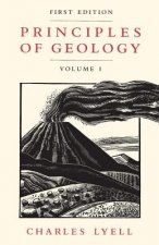
Principles of Geology, Volume 1
32.16 € -31 % -
Plate Tectonics: A Very Short Introduction
11.46 € -19 % -

Igneous and Metamorphic Petrology 2e
151.30 € -

Landscapes and Geomorphology: A Very Short Introduction
11.46 € -19 % -

Ore Deposit Geology
84.32 € -

Soil and Environmental Chemistry
130.80 € -
Tectonic Geomorphology 2e
124.61 € -
Fossils: A Very Short Introduction
11.46 € -19 % -

Earth on Show
65.04 € -
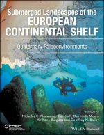
Quaternary Paleoenvironments - Submerged Landscapes of the European Continental Shelf.
139.83 € -

Last Giant of Beringia
29.12 € -
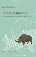
Pleistocene
274.71 € -
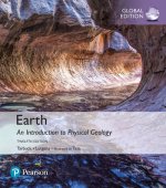
Earth: An Introduction to Physical Geology, Global Edition
87.98 € -
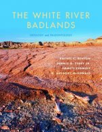
White River Badlands
43.83 € -4 % -
Principles of Geology, Volume 2
77.93 € -
Principles of Geology, Volume 3
77.93 € -
Geomorphology
110.61 €
Osobný odber Bratislava a 2642 dalších
Copyright ©2008-24 najlacnejsie-knihy.sk Všetky práva vyhradenéSúkromieCookies


 21 miliónov titulov
 Vrátenie do mesiaca
 02/210 210 99 (8-15.30h)