Kód: 04709276
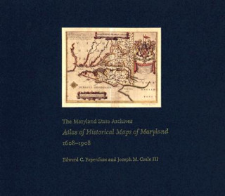
Maryland State Archives Atlas of Historical Maps of Maryland, 1608-1908
Autor Edward C. Papenfuse, Joseph M. Coale, Joseph M. Coale III
Maryland presents cartographers with a formidable test of their skills: unusual natural boundaries, border disputes, and in 1790 the gift of sixty-seven square miles for the creation of the District of Columbia have given the stat ... celý popis
- Jazyk:
 Angličtina
 - Väzba: Pevná
- Počet strán: 240
Nakladateľ: Johns Hopkins University Press, 2003
- Viac informácií o knihe

121.36 €
Dostupnosť:
50 % šanca Máme informáciu, že by titul mohol byť dostupný. Na základe vašej objednávky sa ho pokúsime do 6 týždňov zabezpečiť.
Prehľadáme celý svet
Mohlo by sa vám tiež páčiť
-

Seal Surfer
10.26 € -13 % -

Credo
17.96 € -

Charlie, Meg and Me
12.62 € -13 %
Darčekový poukaz: Radosť zaručená
- Darujte poukaz v ľubovoľnej hodnote, a my sa postaráme o zvyšok.
- Poukaz sa vzťahuje na všetky produkty v našej ponuke.
- Elektronický poukaz si vytlačíte z e-mailu a môžete ho ihneď darovať.
- Platnosť poukazu je 12 mesiacov od dátumu vystavenia.
Informovať o naskladnení knihy
Zadajte do formulára e-mailovú adresu a akonáhle knihu naskladníme, zašleme vám o tom správu. Postrážime všetko za vás.
Viac informácií o knihe Maryland State Archives Atlas of Historical Maps of Maryland, 1608-1908
Nákupom získate 299 bodov
 Anotácia knihy
Maryland presents cartographers with a formidable test of their skills: unusual natural boundaries, border disputes, and in 1790 the gift of sixty-seven square miles for the creation of the District of Columbia have given the state a distinctively irregular configuration. Since the early seventeenth century, generations of mapmakers have met this challenge with artistic imagination and a variety of cartographical techniques. In The Maryland State Archives Atlas of Historical Maps of Maryland, 1608-1908, Edward C. Papenfuse and Joseph M. Coale III bring together in one volume the results of these remarkable efforts, from Captain John Smith's 1608 detailed sketch of the region to the map resulting from the Supreme Court's determination of the state's western border in 1908. Utilizing the latest digital imaging and printing technology, the Atlas contains stunning, full-color reproductions of more than 250 of the most significant historical maps from state and federal archives. This handsome and informative collection-a thoroughly updated and greatly expanded version of the authors' landmark book, The Hammond-Harwood House Atlas of Historical Maps of Maryland (1982)-provides an in-depth history of mapmaking in Maryland and charts the state's early settlement patterns.
 Parametre knihy
Zaradenie knihy Knihy po anglicky Humanities History History: specific events & topics
121.36 €
- Celý názov: Maryland State Archives Atlas of Historical Maps of Maryland, 1608-1908
- Autor: Edward C. Papenfuse, Joseph M. Coale, Joseph M. Coale III
- Jazyk:
 Angličtina
 - Väzba: Pevná
- Počet strán: 240
- EAN: 9780801872358
- ID: 04709276
- Nakladateľ: Johns Hopkins University Press
- Hmotnosť: 2428 g
- Rozmery: 369 × 318 × 22 mm
- Dátum vydania: 25. April 2003
Obľúbené z iného súdka
-

Man's Search for Meaning
7.28 € -5 % -

Women, Race & Class
10.05 € -23 % -

The Rape of Nanking
16.01 € -23 % -

Conquerors
11.90 € -18 % -

Delirious New York
30.18 € -16 % -

Edge of the World
14.88 € -23 % -

Influence of Sea Power Upon History, 1660-1783
25.35 € -19 % -

Siam Mapped
38.80 € -

The Complete MAUS
18.78 € -14 % -

Man's Search For Meaning
16.62 € -23 % -

Holocaust Industry
12.41 € -15 % -

Ordinary Men
10.98 € -24 % -

Homo Deus
12.82 € -24 % -

Bloodlands
12.93 € -24 % -

Eichmann in Jerusalem
11.08 € -23 % -

Brief History of Japan
14.06 € -19 % -

Secret Lives of Colour
14.67 € -24 % -

Scouting for Boys
10.87 € -20 % -

Ascent of Money
17.96 € -14 % -

If This Is A Man/The Truce
14.47 € -23 % -

Imperialism: The Highest Stage of Capitalism
7.49 € -13 % -

East West Street
10.26 € -24 % -

Mein Kampf - The Ford Translation
42.09 € -

Stoned
11.18 € -23 % -

Diary of a Young Girl
9.64 € -

French Revolution
15.49 € -23 % -

Twelve Years a Slave
3.58 € -24 % -

Diary of a Young Girl
10.16 € -22 % -

More Money Than God
18.68 € -17 % -

Women's Work
20.11 € -20 % -

Origins of Museums
59.13 € -17 % -

Eichmann in Jerusalem
15.39 € -21 % -

Mein Kampf
31.92 € -

Square and the Tower
15.08 € -24 % -

My Mad Fat Diary
12.31 € -23 % -

Monk
9.44 € -17 % -

History of the World in Twelve Maps
16.62 € -23 % -

Empires of the Sea
14.47 € -23 % -

White Gold
14.47 € -23 % -

Titanic and Other Ships
13.95 € -

Golden Atlas
27.51 € -23 % -

Access to History for the IB Diploma Rights and protest Study and Revision Guide
37.88 € -

Kafka Was the Rage
16.11 € -8 % -

Better Angels of Our Nature
20.94 € -23 % -

Good Night Stories for Rebel Girls: 50 Postcards
15.70 € -5 % -

Night
11.18 € -23 % -

Victorian House
18.78 € -23 % -

World Until Yesterday
16.62 € -23 % -

This Way for the Gas, Ladies and Gentlemen
13.85 € -21 %
Osobný odber Bratislava a 2642 dalších
Copyright ©2008-24 najlacnejsie-knihy.sk Všetky práva vyhradenéSúkromieCookies


 21 miliónov titulov
 Vrátenie do mesiaca
 02/210 210 99 (8-15.30h)