Kód: 18907465
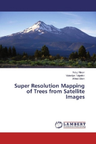
Super Resolution Mapping of Trees from Satellite Images
Autor Nduji Nixon, Valentyn Tolpekin, Alfred Stein
The objective of this book is to address the reliability of individual tree crown objects detected from coarse resolution satellite images. It also provides useful information that will support the capacity of monitoring agricultu ... celý popis
- Jazyk:
 Angličtina
 - Väzba: Brožovaná
- Počet strán: 68
Nakladateľ: LAP Lambert Academic Publishing, 2018
- Viac informácií o knihe

Mohlo by sa vám tiež páčiť
-

Japanese Picture Dictionary Coloring Book
16.77 € -

Cruel Prince (The Folk of the Air)
8.99 € -17 % -

SAP S/4HANA Financial Accounting Certification Guide
65.36 € -19 % -

Kiss Quotient
7.66 € -20 % -

Cruising Utopia, 10th Anniversary Edition
30.78 € -10 % -

Spomeniks
37.43 € -

Diary of a Wimpy Kid book 2
6.84 € -24 % -

The Art and Science of Trading: Course Workbook
49.91 € -2 % -

Library at Mount Char
15.85 € -14 % -

Rap Year Book
20.45 € -15 % -

Pro Hibernate 3
39.38 € -4 % -

Very Pointless Quiz Book
12.27 € -23 % -

Płynność finansowa determinantą zdolności kontynuacji działalności przedsiębiorstwa
15.54 € -8 % -

Disney y Thermomix
29.66 € -10 %
Darčekový poukaz: Radosť zaručená
- Darujte poukaz v ľubovoľnej hodnote, a my sa postaráme o zvyšok.
- Poukaz sa vzťahuje na všetky produkty v našej ponuke.
- Elektronický poukaz si vytlačíte z e-mailu a môžete ho ihneď darovať.
- Platnosť poukazu je 12 mesiacov od dátumu vystavenia.
Viac informácií o knihe Super Resolution Mapping of Trees from Satellite Images
Nákupom získate 96 bodov
 Anotácia knihy
The objective of this book is to address the reliability of individual tree crown objects detected from coarse resolution satellite images. It also provides useful information that will support the capacity of monitoring agricultural change in data sparse regions or developing countries of the world. Mapping of trees from satellite imageries in Africa and most developing countries of the world is quite challenging. The challenges can be attributed to the indiscriminate planting of trees dispersed within heterogeneous and indistinct fields, widespread shortage of up to date agricultural data which is partly due to lack of funds, poor government policies and restrictions to finer resolution imageries due to security concerns. Despite these limitations, satellite imageries still remain a viable option to mapping agricultural information in data sparse regions of the world. With the launching of Sentinel satellite missions by the European space agency (ESA), medium and coarse resolution satellite imageries has become freely available at much better scale. Therefore, most developing countries will like to leverage on this opportunity for up to date monitoring of the environment.
 Parametre knihy
38.66 €
- Celý názov: Super Resolution Mapping of Trees from Satellite Images
- Autor: Nduji Nixon, Valentyn Tolpekin, Alfred Stein
- Jazyk:
 Angličtina
 - Väzba: Brožovaná
- Počet strán: 68
- EAN: 9786134969352
- ID: 18907465
- Nakladateľ: LAP Lambert Academic Publishing
- Hmotnosť: 119 g
- Rozmery: 220 × 150 × 4 mm
- Rok vydania: 2018
Obľúbené z iného súdka
-

Dune
10.53 € -14 % -

Haunting Adeline
30.78 € -

Berserk Deluxe Volume 2
52.27 € -

White Nights
4.08 € -13 % -

Powerless
11.96 € -8 % -

Atomic Habits
15.95 € -15 % -

Dune Messiah
8.99 € -20 % -

Berserk Deluxe Volume 3
51.65 € -

One Day
12.57 € -13 % -

Berserk Deluxe Volume 1
48.28 € -5 % -

Iron Flame
16.26 € -19 % -

Surrounded by Idiots
11.75 € -21 % -

Harry Potter and the Prisoner of Azkaban (Minalima Edition)
27.20 € -33 % -

Gravity Falls Journal 3
22.09 € -

Heaven Official's Blessing: Tian Guan Ci Fu (Novel) Vol. 1
21.47 € -

The Creative Act
24.03 € -13 % -

Dune
9.71 € -19 % -

Hunting Adeline
31.81 € -

A Little Life
17.48 € -

Children of Dune
8.79 € -22 % -

Heaven Official's Blessing: Tian Guan Ci Fu (Novel) Vol. 2
22.09 € -

Bungo Stray Dogs, Vol. 8 (light novel)
16.56 € -

Percy Jackson and the Olympians 5 Book Paperback Boxed Set
43.67 € -5 % -

Solo Leveling, Vol. 1
22.91 € -

The Prisoner's Throne
11.45 € -4 % -

Court of Thorns and Roses
9.30 € -20 % -

Cry Baby Coloring Book
9.81 € -13 % -

Fourth Wing
16.67 € -16 % -

Icebreaker
9.20 € -23 % -

Berserk Deluxe Volume 6
51.14 € -

Avatar, the Last Airbender: The Kyoshi Novels (Box Set)
27.51 € -33 % -

The 48 Laws of Power
26.90 € -1 % -

House of Leaves
23.21 € -4 % -

Twisted Lies
9.81 € -24 % -

Dune Messiah
10.02 € -31 % -

No Longer Human
16.56 € -

48 Laws Of Power
22.60 € -5 % -

Twisted Games
9.81 € -24 % -

Caraval Paperback Boxed Set
39.79 € -8 % -

Solo Leveling, Vol. 2
22.39 € -

Open Circuits
34.47 € -16 % -

Berserk Deluxe Volume 5
50.53 € -1 % -

Heaven Official's Blessing: Tian Guan Ci Fu (Novel) Vol. 3
19.73 € -5 % -

Berserk Deluxe Volume 4
51.65 € -

Court of Mist and Fury
10.42 € -13 % -

SOLO LEVELING V08
22.39 € -

English File Upper Intermediate Multipack A (4th)
23.62 € -

CHAINSAW MAN V14
11.24 € -14 % -

Before the Coffee Gets Cold
9.09 € -16 %
Osobný odber Bratislava a 2642 dalších
Copyright ©2008-24 najlacnejsie-knihy.sk Všetky práva vyhradenéSúkromieCookies


 21 miliónov titulov
 Vrátenie do mesiaca
 02/210 210 99 (8-15.30h)