Kód: 05093042
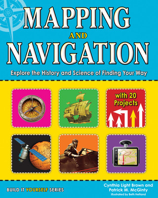
Mapping and Navigation
Autor Cynthia Light Brown, Patrick McGinty
How did we get from 20-foot-long maps to GPS devices small enough to fit in the palm of our hands? How does GPS work and what can it tell us? How do ancient mapmaking techniques used by the Romans and Greeks influence the satellit ... celý popis
- Jazyk:
 Angličtina
 - Väzba: Brožovaná
- Počet strán: 128
Nakladateľ: Nomad Press, 2013
- Viac informácií o knihe

20.74 €
Dostupnosť:
50 % šanca Máme informáciu, že by titul mohol byť dostupný. Na základe vašej objednávky sa ho pokúsime do 6 týždňov zabezpečiť.
Prehľadáme celý svet
Mohlo by sa vám tiež páčiť
-

Big Red One
33.52 € -

Shakespeare and the Power of Performance
67.56 € -

Mycobacteria
276.70 € -

Uniform Random Numbers
226.31 € -

Man/Machine Interaction in the Work of Stanley Kubrick
65.31 € -

LIGHT WIND LIGHT LIGHT
19 € -2 % -

Karl der Große - Charlemagne, m. 2 Buch, 2 Teile, 2 Audio-CD
15.43 €
Darujte túto knihu ešte dnes
- Objednajte knihu a vyberte Zaslať ako darček.
- Obratom obdržíte darovací poukaz na knihu, ktorý môžete ihneď odovzdať obdarovanému.
- Knihu zašleme na adresu obdarovaného, o nič sa nestaráte.
Informovať o naskladnení knihy
Zadajte do formulára e-mailovú adresu a akonáhle knihu naskladníme, zašleme vám o tom správu. Postrážime všetko za vás.
Viac informácií o knihe Mapping and Navigation
Nákupom získate 51 bodov
 Anotácia knihy
How did we get from 20-foot-long maps to GPS devices small enough to fit in the palm of our hands? How does GPS work and what can it tell us? How do ancient mapmaking techniques used by the Romans and Greeks influence the satellite technologies we use today? The history of mapmaking is full of remarkable characters who charted the unknown with an ever-changing set of tools. In Mapping and Navigation: The History and Science of Finding Your Way, kids ages 9-12 will learn the history and science behind the evolution of mapmaking, and how much is still out there for discovery. Readers will explore ideas through hands-on experiments while learning new terminology and interesting facts. Projects include using triangulation to measure distances, creating contour lines on a mini-mountain to understand elevation changes on a map, and inventing a sundial and compass to understand the basics of navigation. Whether mapping the solar system or mapping their own backyard, all readers will be able to understand mapping technologies and see the world in new and exciting ways.
 Parametre knihy
Zaradenie knihy Knihy po anglicky Children's, Teenage & educational Picture books, activity books & early learning material Interactive & activity books & packs
20.74 €
- Celý názov: Mapping and Navigation
- Autor: Cynthia Light Brown, Patrick McGinty
- Jazyk:
 Angličtina
 - Väzba: Brožovaná
- Počet strán: 128
- EAN: 9781619301986
- ISBN: 1619301989
- ID: 05093042
- Nakladateľ: Nomad Press
- Hmotnosť: 312 g
- Rozmery: 251 × 204 × 10 mm
- Dátum vydania: 01. October 2013
Obľúbené z iného súdka
-

My First Keyboard Book
14.20 € -2 % -

Ultimate Book of Vehicles
23.60 € -8 % -

Beautiful Colour by Numbers
8.99 € -23 % -

Worlds Within Worlds
13.07 € -9 % -

Animal Orchestra Plays Beethoven
16.24 € -13 % -

Ultimate Book of Cities
25.03 € -4 % -

Lift-the-Flap My Day
11.13 € -23 % -

Little Sticker Dolly Dressing Kittens
7.04 € -21 % -

Flowers Colour by Numbers
13.07 € -

Baby Touch and Feel Farm Animals
5.71 € -23 % -

Baby's Bedtime Music Book
13.38 € -21 % -

Throne of Glass Colouring Book
9.80 € -24 % -

Alice's Adventures in Wonderland Pop-Up Book
33.62 € -13 % -

Graffiti Coloring Book
8.99 € -23 % -

First Book about the Orchestra
13.28 € -21 % -

Sticker Dolly Dressing Fashion Designer London Collection
8.99 € -23 % -

Mein dickes Malen-nach-Zahlen-Buch - Fahrzeuge
7.45 € -2 % -

Lift-the-flap Questions and Answers about Animals
12.26 € -23 % -

Big Sticker Book of Beasts
11.13 € -23 % -

Baby Touch: Colours
7.45 € -

Richard Scarry´s A Day at the Airport
7.04 € -4 % -

Touch and Feel Baby Animals (Scholastic Early Learners)
6.74 € -19 % -

Ladybird lift-the-flap book: Busy Building Site
8.99 € -23 % -

Baby Touch: Vehicles Tab Book
8.99 € -23 % -

Eyelike Stickers: Animals
6.02 € -19 % -

Millie Marotta's Brilliant Beasts
10.83 € -20 % -

Color & Learn Easy Italian Phrases for Kids
3.87 € -12 % -

See Inside Bridges, Towers and Tunnels
12.26 € -23 % -

Caterpillar to Butterfly
8.27 € -21 % -

Chronicles of Narnia Colouring Book
10.21 € -

Farm Sounds
14.71 € -21 % -

Calm Colour by Numbers
10.21 € -13 % -

Bluey: Let's Play Outside!
10.11 € -22 % -

Four Seasons
14.30 € -15 % -

Animal Orchestra Plays Mozart
14.40 € -23 % -

Creative Haven Country Kitchen Charm Coloring Book
6.74 € -19 % -

Encyclopedia Prehistorica Dinosaurs
38.12 € -23 % -

Flags of the World to Colour
7.45 € -16 % -

Wind-up Train
24.52 € -14 % -

Listen and Learn First German Words
14.40 € -13 % -

Diary of a Wimpy Kid: Do-It-Yourself Book
8.07 € -

Get Ready for School (Listen & Learn)
12.77 € -23 % -

Jungle Sounds
14.40 € -24 % -

Curious George Storybook Collection
17.37 € -

Poppy and Sam's Easter Egg Hunt
6.84 € -23 % -

200 Paper Planes to fold & fly
11.13 € -23 % -

Eyelike Ocean - 400 Reusable Stickers Inspired by Nature
6.43 € -25 % -

Zoo Sounds
15.73 € -16 % -

Bluey: Fun and Games: A Colouring Book
7.96 € -22 %
Osobný odber Bratislava a 2642 dalších
Copyright ©2008-24 najlacnejsie-knihy.sk Všetky práva vyhradenéSúkromieCookies


 21 miliónov titulov
 Vrátenie do mesiaca
 02/210 210 99 (8-15.30h)